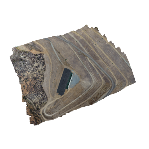
Pix4D created terrain model using MapPilot app with a DJI Phantom 4 @ 60m AGL
A 3D terrain model created using the DJI Phantom 4 and photos processed using Pix4D. Roughly 2.5cm GSD (Ground Sample Distance). Reflective and highly uniform surfaces can confuse the photogrammetry software. That is part of why the car and metal awning and the black runways are very uneven and have bulges and surface "artifacts". This can be cleaned up with 3D model software. There was no 3D point cloud post processing/editing done on this model. This is just photos taken by drone which was under autopilot using the Map Pilot app from Drones Made Easy, to Pix4D and processed in Pix4D using standard options. No other software or editing was done.